Todays Conditions
Temperature: 28°F
Wind: NW 18 mph Gusts 41 mph
Dew pont: 5°F
Humidity: 39%
Pressure 30.21"
I high pressure front just moved thought the area resulting in high winds. as this rapid pressure change takes place the leading edge of the front will produce stung winds for the next several hours. This morning started out clear with mild winds out of the west cirrus cloud began to move in and by noon we were seeing alto stratus clouds as the wind continued to come out of the west. temperatures were cold today due to the change in wind direction and the high pressure front coming in from the rookies. the high pressure looks like it will stick around fro tomorrow but move out by Saturday
Friday, March 9, 2012

Wednesday, March 7, 2012
Wednesday's Weather
Today’s Conditions
Temperature: 48F
Wind: 8mph SSW gusts 11 mph
Dew Point: 42F
Humidity: 82%
Pressure: 29.55"
The temperature is extremely high the wind is still pretty strong out of the south and the clouds keep building. We now have what looks like cumulostratus clouds overhead. The radar shows rain showed beginning to develop to the north of us I think that will continue and the air masses continue to mix and within a few hours well see some rain. The air is humid and the dew point is fairly high as this low pressure continues to push out the cold front conditions are right for spring showers.


Temperature: 48F
Wind: 8mph SSW gusts 11 mph
Dew Point: 42F
Humidity: 82%
Pressure: 29.55"
The temperature is extremely high the wind is still pretty strong out of the south and the clouds keep building. We now have what looks like cumulostratus clouds overhead. The radar shows rain showed beginning to develop to the north of us I think that will continue and the air masses continue to mix and within a few hours well see some rain. The air is humid and the dew point is fairly high as this low pressure continues to push out the cold front conditions are right for spring showers.
Tuesday, March 6, 2012
Tuesday's Weather
Todays Conditions
Temperature: 47°F
Wind: 0mph Gusts S 13mph
Dew Point 39°F
Humidity: 74%
Pressure: 29.61
Todays was a beautiful day. It started out crystal clear and cold, the temps were in the low 20's early this morning. However things warmed up fast as the warm front moved in, we observed the south east wind bringing in this warm front, cirrus clouds were over head by 8:30 and remained there as the wind died down a little. By 4pm the cirrostratus cloud associated with the warm front were visible on the horizon. the warm front is bringing low pressure that looks like it will produce precipitation by morning. the thinking layer of clouds will trap some of the days heat in and keep temps probably above freezing all night.
The warm weather did in fact bring the fish to the surface for a little bit making for a beautiful after noon of weather watching and dry fly fishing. I managed to trick 2 nice browns into taking by hand tied dry fly.

Temperature: 47°F
Wind: 0mph Gusts S 13mph
Dew Point 39°F
Humidity: 74%
Pressure: 29.61
Todays was a beautiful day. It started out crystal clear and cold, the temps were in the low 20's early this morning. However things warmed up fast as the warm front moved in, we observed the south east wind bringing in this warm front, cirrus clouds were over head by 8:30 and remained there as the wind died down a little. By 4pm the cirrostratus cloud associated with the warm front were visible on the horizon. the warm front is bringing low pressure that looks like it will produce precipitation by morning. the thinking layer of clouds will trap some of the days heat in and keep temps probably above freezing all night.
The warm weather did in fact bring the fish to the surface for a little bit making for a beautiful after noon of weather watching and dry fly fishing. I managed to trick 2 nice browns into taking by hand tied dry fly.

Monday, March 5, 2012
Monday's Weather
Today’s Conditions
Temperature: 28F
Wind: 7 mph SSW Gusts 7 mph
Dew Point: 17F
Humidity 63%
Pressure: 30.18"
There's currently a layer of alto stratus clouds overhead, the winds out of the south and is bringing warmer air up our way. We’re currently seeing a low pressure system slowly move in from the west. This system also contains warm air and should cause the temps to rise nicely tomorrow. For the rest of the day, look for temps to rise quickly into the mid 30's and the clouds to hang around for the rest of the day.
Even though the weathers pretty boring today its excellent for fishing. The above freezing temperatures will bring out the midges and cause trout activity to increase. They were pretty slow moving this weekend due to the cold snap, and are probably hungry and feeding on the surface. The water levels have been really good, but the warmer weather will cause the snow to melt and look for the rivers to start to rise a little today. It will be interesting to see how much snow melts tomorrow; if the temps are in the 50's it could result in high water during mid-week.
Temperature: 28F
Wind: 7 mph SSW Gusts 7 mph
Dew Point: 17F
Humidity 63%
Pressure: 30.18"
There's currently a layer of alto stratus clouds overhead, the winds out of the south and is bringing warmer air up our way. We’re currently seeing a low pressure system slowly move in from the west. This system also contains warm air and should cause the temps to rise nicely tomorrow. For the rest of the day, look for temps to rise quickly into the mid 30's and the clouds to hang around for the rest of the day.
Even though the weathers pretty boring today its excellent for fishing. The above freezing temperatures will bring out the midges and cause trout activity to increase. They were pretty slow moving this weekend due to the cold snap, and are probably hungry and feeding on the surface. The water levels have been really good, but the warmer weather will cause the snow to melt and look for the rivers to start to rise a little today. It will be interesting to see how much snow melts tomorrow; if the temps are in the 50's it could result in high water during mid-week.
Sunday, March 4, 2012
saturday/sundays weahter
Saturday
Highs in the upper 20's winds at 15 to 20 mph stratus cloud and intermittent snow best characterize yesterdays weather. The intense low pressure system that rolled in and bought all the nasty weather was starting to move out, but was still producing some light snow.
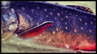
yesterday was the early season trout opener the weather was not pleasant for fishing I couldn't feel my fingers or toes for the better part of the day. This cold front was more like December weather than the beginning of March. the snow was beautiful to watch on the trout stream but the cold is not appreciated. thankfully the cold front has started to pass and spring like weather is in the forecast.


 Sundays Conditions
Current temp: 17°F
Todays high: 25°F
Wind: 0 mph gusts W 7 mph
Dew Point: 10°F
Humidity: 74%
Pressure: 30.03"
Today started much like yesterday. Intermittent light snow fell again today around noon, but by about about 4 the stratus clouds broke and cumulus clouds moved in. The wind died downed and the high pressure system moved in bringing clear skies. As this front moves in it will bring nice warm weather this week.

Highs in the upper 20's winds at 15 to 20 mph stratus cloud and intermittent snow best characterize yesterdays weather. The intense low pressure system that rolled in and bought all the nasty weather was starting to move out, but was still producing some light snow.
yesterday was the early season trout opener the weather was not pleasant for fishing I couldn't feel my fingers or toes for the better part of the day. This cold front was more like December weather than the beginning of March. the snow was beautiful to watch on the trout stream but the cold is not appreciated. thankfully the cold front has started to pass and spring like weather is in the forecast.


Current temp: 17°F
Todays high: 25°F
Wind: 0 mph gusts W 7 mph
Dew Point: 10°F
Humidity: 74%
Pressure: 30.03"
Today started much like yesterday. Intermittent light snow fell again today around noon, but by about about 4 the stratus clouds broke and cumulus clouds moved in. The wind died downed and the high pressure system moved in bringing clear skies. As this front moves in it will bring nice warm weather this week.
Friday, March 2, 2012
Fridays weather
Todays Conditions
Temperature: 36°F
Wind: W 7mph gusts W 8 mph
Dew Point 31°F
Humidity: 85%
Pressure 29.56"
Low pressure persists thought out the mid west today bringing stratus clouds to us, but intense storms else where. Souther Wisconsin is getting hit with heavy snow fall and rain right now creating dangerous driving conditions and low visibility. They are experiencing a storm very similar to what we got this week. They may even get more precipitation. The surface data is showing similar pattern to what we saw this week. moist air is being pulled up from the gulf and is swirling around over wisconsin and continues to feed the large low pressure system thats siting over the mid west. This is whats continuing to generate there large powerful storms. Tornadoes are being reported as currently on the ground in Tennessee, Kentucky and Ohio. Sever thunderstorms are being produced by this system and are stretching from Louisiana to Illinois.
This weather channel video is talking about the tornado forecast for this afternoon there is a very good change for a serious tornado outbreak today.
http://www.weather.com/weather/videos/news-41/top-stories-169/latest-forecast-for-severe-weather-365#loc=62/436/26315

Temperature: 36°F
Wind: W 7mph gusts W 8 mph
Dew Point 31°F
Humidity: 85%
Pressure 29.56"
Low pressure persists thought out the mid west today bringing stratus clouds to us, but intense storms else where. Souther Wisconsin is getting hit with heavy snow fall and rain right now creating dangerous driving conditions and low visibility. They are experiencing a storm very similar to what we got this week. They may even get more precipitation. The surface data is showing similar pattern to what we saw this week. moist air is being pulled up from the gulf and is swirling around over wisconsin and continues to feed the large low pressure system thats siting over the mid west. This is whats continuing to generate there large powerful storms. Tornadoes are being reported as currently on the ground in Tennessee, Kentucky and Ohio. Sever thunderstorms are being produced by this system and are stretching from Louisiana to Illinois.
This weather channel video is talking about the tornado forecast for this afternoon there is a very good change for a serious tornado outbreak today.
http://www.weather.com/weather/videos/news-41/top-stories-169/latest-forecast-for-severe-weather-365#loc=62/436/26315
Thursday, March 1, 2012
Thursdays Weather
Todays Conditions
Temperature: 32°F
Wind: 1mph S gusts 4mph
Dew Point: 31°F
Humidity 100%
Pressure 29.76"
today was cold and damp. the temperature never got much above 32 and and the south wind fourth more damp air to the area creating a type of cold that will cut right throughout you. starts clouds blanketed the area today and are now producing some light snow fall. It's mainly to the north of us but we are currently getting some intermitten light snow.

Temperature: 32°F
Wind: 1mph S gusts 4mph
Dew Point: 31°F
Humidity 100%
Pressure 29.76"
today was cold and damp. the temperature never got much above 32 and and the south wind fourth more damp air to the area creating a type of cold that will cut right throughout you. starts clouds blanketed the area today and are now producing some light snow fall. It's mainly to the north of us but we are currently getting some intermitten light snow.
Subscribe to:
Posts (Atom)